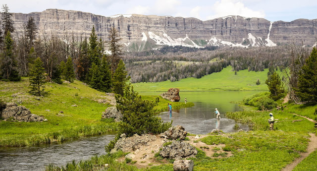
I wandered up and down, over the green hills that lay underneath the Absaroka Range. This rugged range is emblematic of the highlands of western Wyoming and forms much of the border with Montana. This is another isolated chunk of the journey, and much of the trail here is barely maintained, so I took care to pay attention to the road and my GPS to keep my bearings and avoid getting lost.
I hiked up Togwotee Pass, which lies at an elevation of 9,655 ft (2,943 m) above sea level. I clambered up the slopes until I reached its tops and admired the view, the sharp peaks of the Grand Tetons in the distance, and the pathway of the CDT, winding like a ribbon towards Yellowstone below. In the foreground were the famous volcanic pinnacles of the Breccia Cliffs and Pinnacle Buttes. These high rocky cliffs rise abruptly out of the pine forest, their craggy boulders making them resemble a medieval castle. Lava sculpted these incredibly complex structures millions of years ago and rock climbers are urged to stay away from these very tempting cliff faces, as the rocks here are made of breccia, basically a kind of rubble held together with prehistoric mud, making the rock brittle and causing handholds to easily break away.
Not only are the views breathtaking, but there’s some interesting history here too. The Pass is named after a chief of the Shoshone Sheepeater tribe who guided the Jones Expedition over it in 1873. Various tribes had been using the navigable footpaths leading over it as a trade route for centuries, but the Jones Expedition mapped and documented the area for the United States in their quest to find a route for wagons connecting the south of Wyoming with the north.
After savouring the view
for a few more minutes, I began the long descent to the lowlands, continuing my
journey to the Tetons wilderness.


No comments:
Post a Comment
It's so good to see you here . . .